Sweden is on course to have its worst drought since 2018, destroying harvests, threatening livestock, and risking a repeat of that year's devastating forest fires. These maps set out the situation.
How dry are Sweden's forests?
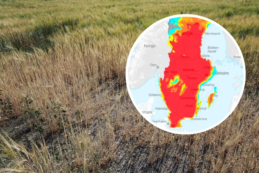
On June 8th, almost every part of Sweden south of Gävle was rated as "dry", "very dry", or "extremely dry" (yellow, orange, and red) in this map prepared by Sweden's state-run surveyor Lantmäteriet for the state meteorologist SMHI and the Civil Contingencies Agency (MSB) You can find an interactive map here
This map shows the bränsleuttorkning, or fuel dryness, an estimate of how much, dry burnable leaves and branches are on forest floors in Sweden.
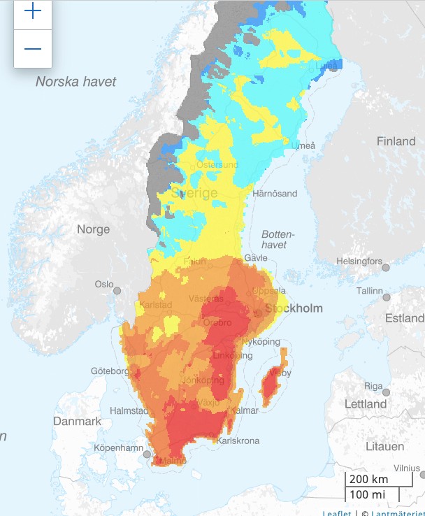
The assessment of the amount of dry wood in Sweden's forests. Graphic: Lantmäteriet/SMHI
The surveyor also prepares a second map for SMHI and MSB showing the risk of forest fire assessed using the FWI (Fire Weather Index), an index created in Canada which combines measures of air humidity, temperature, 24-hour precipitation and wind speed.
This shows that a lot of areas are already at an "extremely high risk of a forest fire" (red), particularly just south of Västeras, and that large parts of Sweden south of Gävle are at a "very high risk" (dark orange) or "at risk" (orange).
Advertisement
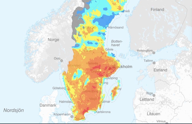
The Fire Weather Index map for Sweden on June 8th. Graphic: Lantmäteriet
Sweden's authorities expect the situation to get much worse in the coming week, with "extremely high risk" of forest fire across most of the country by June 12th.
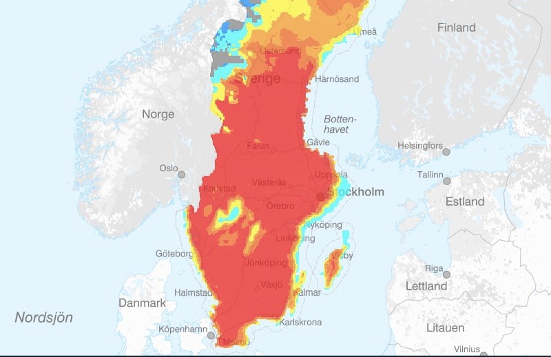
The Fire Weather Index shows an "extremely high risk" of forest fire on Monday June 12th. Photo: Lantmäteriet
What measures are in place in Sweden?
Municipalities everywhere south of Norrland have already put in place fire bans, or eldförbud, which prevent people from lighting fires or barbecues outside. The only exception is the municipality of Svedala in Skane.

Almost everywhere in Sweden south of Gävle now has a barbecue ban or 'eldförbud' in place. Photo: Lantmäteriet
Is there a risk of water shortages?
Ground water levels in small watercourses are currently high or very high compared to the average level in 1961 to 2022 (light green, green and dark green in map to the left) in most of northern Sweden, at about normal levels (light blue) across most of central Sweden, and low in the south of Västra Götaland, Halland, Småland, parts of Blekinge and Skane.
Comparing groundwater water levels to the same week in 1961 to 2022, it's "under normal" across the south of Västra Götaland, Halland, Småland, parts of Blekinge and Skane (yellow in map to the left), and normal in most of central and northern Sweden.
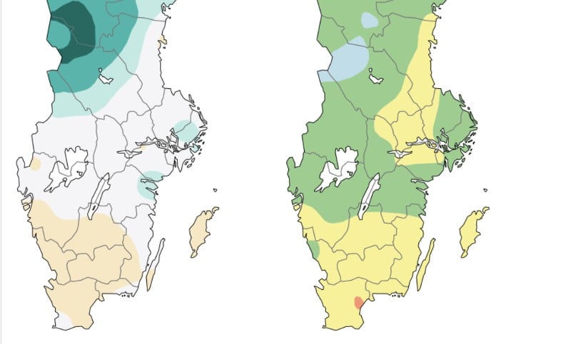
Groundwater levels in Sweden on June 8th 2023. Graphic: Geological Survey of Sweden
Comments